Project Summary
Our objective with this project was to create a program for our turtlebot to navigate and explore its environment using a LiDAR sensor. The robot must first create a map of its environment using the SLAM gmapping node. Additionally, the robot is capable of localizing itself from any random spot on the map using AMCL. To accomplish the objective, our robot is capable of localizing itself in an environment, precisely driving around a map, creating optimal path plans, identifying frontiers, and finally identifying when there are no more frontiers.
Mapping
Using AMCL the robot can reliably find where its position is by using the map generated by GMapping. To do this, the robot rotates in place by a constant velocity until the covariance of X, Y position and Z rotation is lower than a set threshold. After the robot stops localizing, it will follow a selected path using A* to generate it and Pure Pursuit to follow. In cases where the robot incorrectly localizes, the robot will relocalize and generate new particles to estimate its pose again.

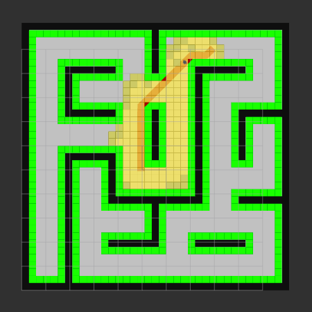
Navigation
In order to navigate and explore it's enviroment, the turtlebot uses A* to create paths, and a variation of pure pursuit to follow them. To decide where to go, the robot autonomously evaluates the map's frontiers and c-space, and selects the location that will lead to the greatest increase in exploration. Once no more frontiers are available, the robot navigates back to it's start location.